Journey to the Summit: Exploring Mt. Nantai

- タイム
- 5:01
- 距離
- 7.9km
- 上昇量
- 1241m
男体山 / TaK 🔰さんの男体山の活動データ | YAMAP / ヤマップ
Mt. Nantai: A Mountain of Faith Established by Shodo Shonin
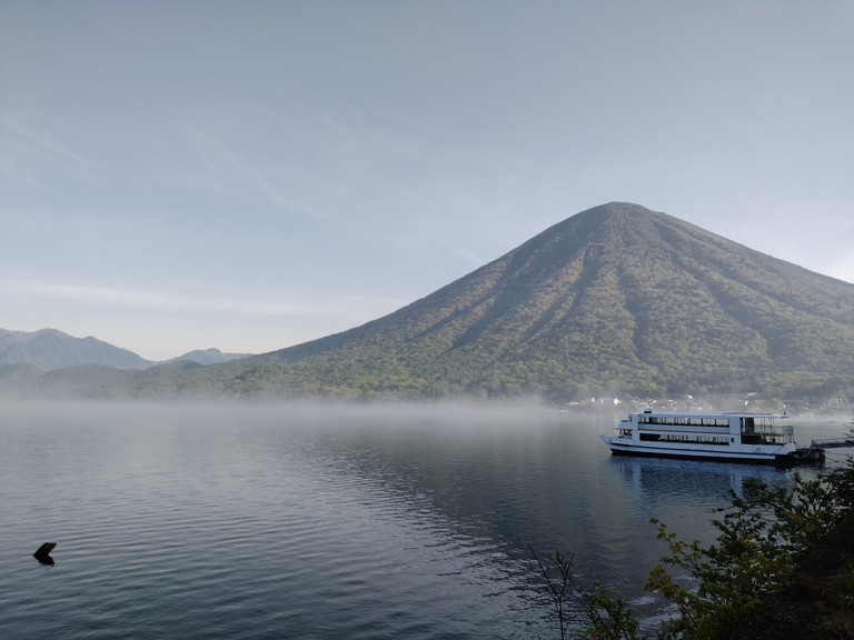
“Mt. Nantai” is a volcanic peak with an elevation of 2,486 meters located in Nikko City, Tochigi Prefecture. It stands magnificently by the shores of Lake Chuzenji, displaying its beautiful presence.
This mountain area has been regarded as a sacred site for mountain worship since it was opened by Shodo Shonin in the year 782. It was formerly known as “Nikko-yama” or “Futara-yama.”
The current name “日光(Nikkou)” is derived from “二荒山(Futarayama),” which transformed from “二荒(Nikou)” to “日光(Nikkou)”.
Meaning of Futarayama
“二” said to refer to Mt. Nantai and Mt. Nyoho.
“荒” a feeling of awe toward the divine spirits.
It is said to mean “Mt. Nantai and Mt. Nyoho, where the raging divine spirits are subdued.”
Origin of Mt. Nantai’s Name
As mentioned above, this mountain range is called 二荒山, and when viewed from the south, a smaller mountain 女峰山(Mt. Nyoho) can be seen nestled against the larger mountain 男体山(Mt. Nantai).
It is believed that the larger mountain, the main peak, is called “Mt. Nantai” and the other is called “Mt. Nyoho” as a pair.


Mt.Taro to the north is considered the eldest son born between Mt.Nantai and Mt.Nyoho, and they are called “Nikko-sanzan” (three mountains of Nikko). Furthermore, “Mt. Omanako” and “Mt. Komanaako” were also born between the couple.
Payment of Admission Fee at Futarayama Shrine, and Off to Mt. Nantai!
Pay the first fee of 1,000 yen at Futaarasan Shrine along with the climbing report, receive an amulet, and climb the mountain.
The period during which you can climb the mountain is from April 25 to November 11.

The itinerary this time was a piste from Futaarasan Shrine to Nantaiyama.
The course time is 6 hours, distance 7.9 km, and cumulative elevation 1,250 m.
Nantai is often commented as “harder than Mt. Fuji,” but looking at the cumulative elevation, I thought it would be okay if we took our time.

There are stairs at first, but soon you will enter uneven terrain.

Continue on the asphalt-paved forest road and then back on the trail.


The path is strewn with rocks like this. Even so, it is easier to walk than Mt.Kurobi

We have gained a lot of elevation. Lake Chuzenji can be seen in the distance.

The temperature that day was about 23 degrees Celsius. It was just the right cool temperature for exercise.
As I was waiting for someone to pass by, something that looked like a mouse crossed my path at high speed at my feet.
At first I thought it was a mole, but its eyes were wide open, so I guessed it was a natural monument, a dormouse.

I came higher than the clouds.

The ninth station…almost there!

As the summit approached, the vegetation decreased and the soil turned reddish and sandy, typical of volcanoes.

Lake Chuzenji and Senjogahara can be seen.

Futaarayama Shrine Okumiya. My time of action up to this point was 2:35.

二荒山大神

The eldest son of Mt. Nantai and Mt.Nyoho:Mt.Taro Shrine

It is the same height as the clouds. The clouds are so close that you can almost reach them by reaching out your hand.
When you are swallowed by the clouds, you feel cool and comfortable because of the mist dancing around you.

The movie “What is your name?” It is like the town of Itomori after the meteorite hit. It is really beautiful scenery.

I climbed Mt. Nantai(2486m)

神鏡。

Holy sword stuck in the rock.

Serious white-blade fighting! At my level, the sword looks stopped.
After a 30-minute rest at the summit enjoying the view, we started our descent.
During the ascent, there was a man sitting at about the 6th station with a face that was more white than blue, and I passed him by wondering if he was okay at the time, but during the descent I encountered a crowd of people, and it was him surrounded by rescue workers.
Fire trucks, police cars, and ambulances were waiting on the forest road at the fourth station.

I can’t believe it was such a big deal for just one person in distress, I was reminded once again of the importance of taking care of one’s health and having the courage to turn back.
So, I managed to get myself home safely.

The duration of the tour was 5 hours including breaks.
お疲れ山でした。


COMMENTS